












How Many Districts Went to Pakistan in 1947 — Jogendra Nath Mandal’s Influence in Bengal partition and demographic reality
By IBG NEWS Desk

As debates resurface around the political legacy of Jogendra Nath Mandal, a recurring question often arises in public discourse: How many districts joined Pakistan because of his support?
The historical answer requires precision, because the partition of Bengal was not decided by any single leader, but Mandal’s political alignment did have symbolic and localized influence.
The Hard Numbers: Districts That Became East Pakistan
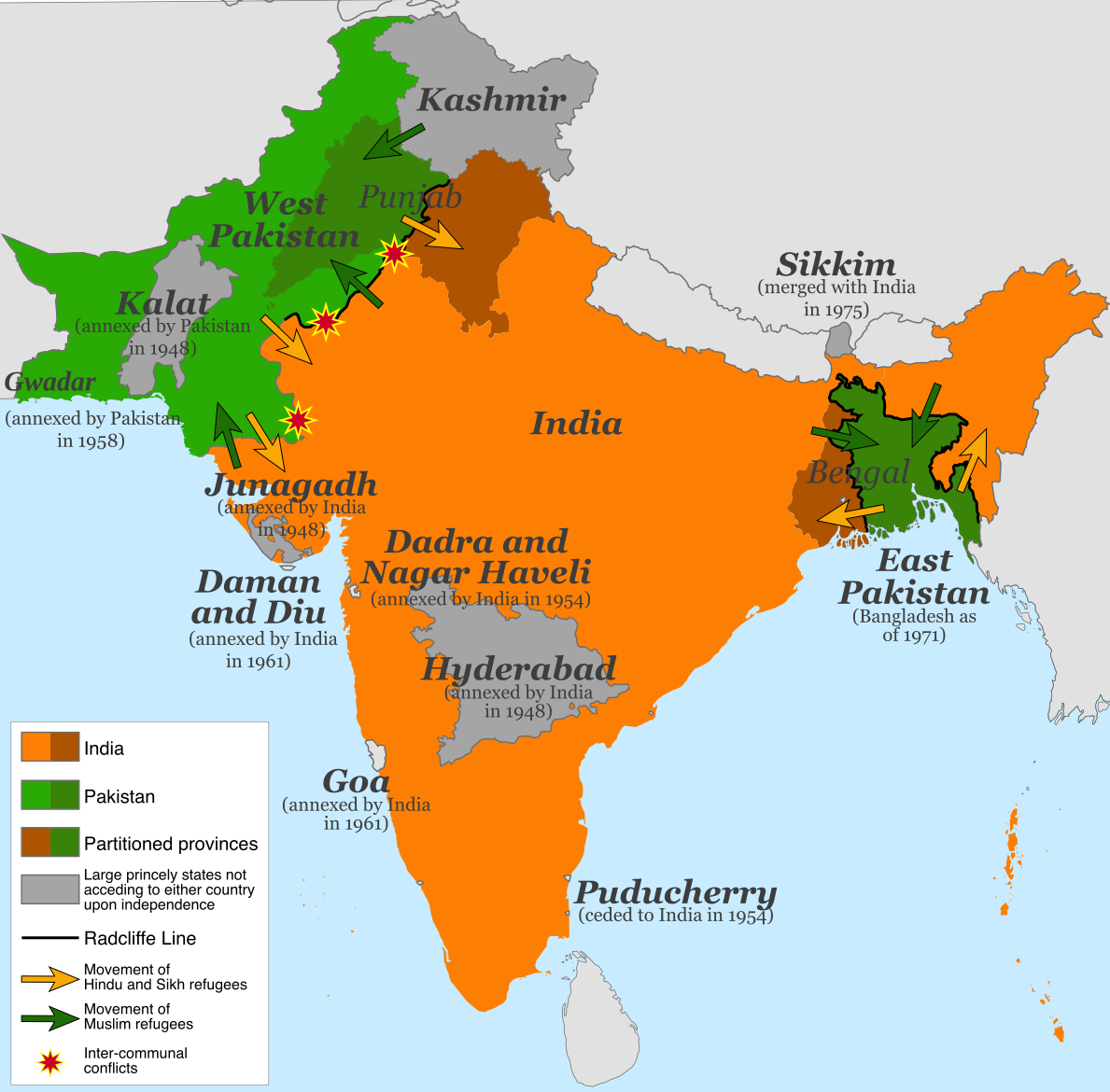
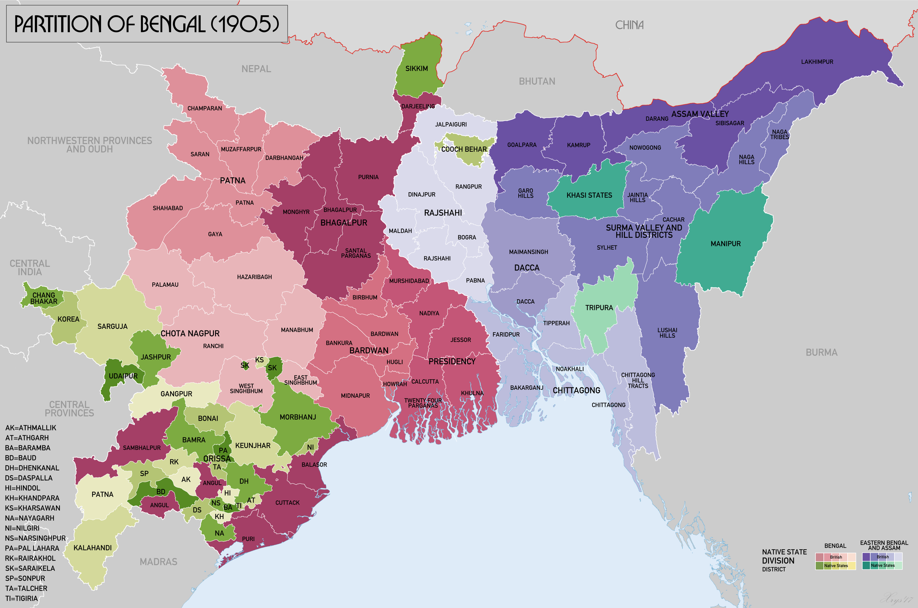
At the time of Partition in 1947, undivided Bengal had 27 districts.
Based on the Radcliffe Award:
- 17 districts went to East Pakistan (later Bangladesh)
- 10 districts remained with India (West Bengal)
Districts that formed East Pakistan (1947)
- Dacca
- Faridpur
- Bakarganj (Barisal)
- Mymensingh
- Tippera (Comilla)
- Noakhali
- Chittagong
- Chittagong Hill Tracts
- Sylhet (after referendum)
- Rajshahi
- Dinajpur (major portion)
- Rangpur
- Bogra
- Pabna
- Jessore
- Khulna
- Kushtia
These districts together formed East Pakistan, home to a large Hindu minority at the time.
Was This “Because of” Jogendra Nath Mandal?
Directly: No.
Indirectly and politically: Partially, at the margins.
Key Clarification
- The Radcliffe Line was drawn by a British commission, based on religious demographics, administrative contiguity, and political negotiations.
- No Indian leader—including Mandal—had the authority to decide districts.
However, Mandal’s support mattered in three indirect ways:
1. Legitimisation of the Muslim League’s Claim in Bengal
As the most prominent Scheduled Caste Hindu leader in Bengal:
- Mandal’s alliance with the Muslim League helped the League argue that
Pakistan was not opposed by all Hindus - This weakened the moral case for a united Bengal within India
In districts with large Namasudra and Dalit populations—such as:
- Faridpur
- Jessore
- Khulna
- Barisal
his political line diluted consolidated Hindu opposition to Partition.
2. Undermining the United Hindu Political Front
During the critical years (1945–47):
- Upper-caste Hindu leadership largely opposed Pakistan
- Mandal openly broke ranks, portraying Congress and Hindu Mahasabha as caste-dominated
This division reduced bargaining strength when Bengal’s fate was negotiated, especially compared to Punjab, where Hindu–Sikh unity was stronger.
3. Psychological and Symbolic Impact
While Mandal did not “deliver” districts, his support:
- Gave the Muslim League confidence that
East Bengal could be governed without Hindu consent - Encouraged the belief that Hindu minorities would adjust within Pakistan
This assumption later proved catastrophically wrong.
Historical Verdict
| Claim | Historical Reality |
|---|---|
| Mandal caused districts to go to Pakistan | ❌ Incorrect |
| Mandal influenced Bengal politics | ✅ Yes |
| 17 districts went to East Pakistan | ✅ Fact |
| His support legitimised Partition narratives | ✅ Partially |
| His expectations were fulfilled | ❌ No |
Link to Present-Day Bangladesh
The fact that 17 districts with ancient Hindu civilisational roots went to Pakistan—and later Bangladesh—forms the backdrop to the steady decline of Hindus from over 22% (1947) to under 8% today.
For critics, this reinforces the argument that Mandal’s political calculation:
- Misread the nature of religious majoritarianism
- Overestimated constitutional guarantees in a religion-based state
His own 1950 resignation letter acknowledged that the assumptions underpinning his support for Pakistan had collapsed.

District-wise Demographic Map of Bengal during the 1947 Partition
(Based primarily on the 1941 Census — the last full census before Partition)
The partition of undivided Bengal was decided largely on district-level religious majorities as recorded in the 1941 Census, along with administrative contiguity. Below is a district-wise demographic snapshot showing why specific districts went to East Pakistan and others to India (West Bengal).
🟩 Districts that went to India (West Bengal) — Hindu-majority
| District (1947) | Hindu % | Muslim % | Outcome |
|---|---|---|---|
| Calcutta | ~73% | ~23% | India |
| Howrah | ~65% | ~33% | India |
| Hooghly | ~68% | ~30% | India |
| Midnapore | ~55% | ~44% | India |
| Bankura | ~80% | ~19% | India |
| Birbhum | ~55% | ~44% | India |
| Burdwan | ~56% | ~42% | India |
| Nadia | ~61% | ~38% | India |
| Murshidabad | ~44% | ~56% | India (strategic exception) |
| 24 Parganas | ~58% | ~41% | India |
Key exception: Murshidabad had a Muslim majority but remained with India due to river systems, Calcutta port access, and administrative logic.
🟨 Districts that went to East Pakistan (East Bengal) — Muslim-majority
| District (1947) | Muslim % | Hindu % | Outcome |
|---|---|---|---|
| Dacca | ~70% | ~29% | East Pakistan |
| Mymensingh | ~69% | ~30% | East Pakistan |
| Faridpur | ~67% | ~32% | East Pakistan |
| Bakarganj (Barisal) | ~72% | ~27% | East Pakistan |
| Tippera (Comilla) | ~76% | ~23% | East Pakistan |
| Noakhali | ~75% | ~24% | East Pakistan |
| Chittagong | ~71% | ~28% | East Pakistan |
| Chittagong Hill Tracts | ~98% tribal (non-Muslim) | — | East Pakistan (strategic) |
| Rajshahi | ~65% | ~34% | East Pakistan |
| Dinajpur (major part) | ~55% | ~44% | East Pakistan |
| Rangpur | ~70% | ~29% | East Pakistan |
| Bogra | ~80% | ~19% | East Pakistan |
| Pabna | ~73% | ~26% | East Pakistan |
| Jessore | ~52% | ~48% | East Pakistan |
| Khulna | ~50–52% | ~48–50% | East Pakistan |
| Kushtia | ~64% | ~35% | East Pakistan |
| Sylhet (Assam) | ~56% | ~43% | East Pakistan (via referendum) |
🗺️ How the Radcliffe Line Used These Demographics
- Primary rule: Muslim-majority districts → Pakistan; Hindu-majority → India
- Exceptions made for:
- River systems (Bhagirathi–Hooghly)
- Port access (Calcutta)
- Administrative coherence
This explains anomalies like:
- Murshidabad → India (despite Muslim majority)
- Chittagong Hill Tracts → Pakistan (despite non-Muslim tribal majority)
📉 Why This Map Still Matters
- In 1947, East Bengal was ~22–23% Hindu
- Today’s Bangladesh has ~7–8% Hindus
- Most districts that went to East Pakistan had substantial Hindu populations (25–45%)
This demographic map explains:
- The scale of refugee migration into West Bengal
- Why Partition trauma remains deeply rooted
- Why political decisions of leaders like Jogendra Nath Mandal are reassessed through a demographic lens
🧭 Conclusion – One-line takeaway
The 1947 Bengal Partition followed district-level religious majorities from the 1941 Census—sending 17 Muslim-majority districts to Pakistan and 10 Hindu-majority districts to India—while leaving behind millions of Hindus in East Bengal, whose demographic decline continues to shape history and politics today.
Jogendra Nath Mandal did not redraw Bengal’s map—but his political alignment shaped the atmosphere in which 17 districts became part of Pakistan.
Those districts today lie in Bangladesh, where the Hindu population continues to shrink, making Partition-era choices feel painfully contemporary.
History thus judges Mandal less by intent and more by outcome—a reminder that symbolic political endorsements during civilizational ruptures can carry consequences far beyond their immediate context.
*** Please refer to official government notifications for any official reference, as data may vary for different sources referred.***